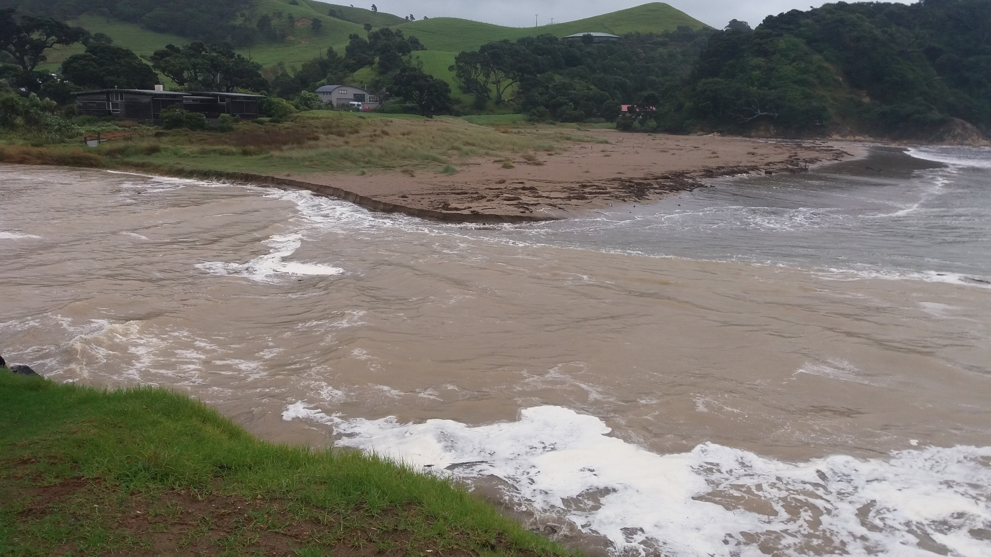
Hopefully shift some of the sand that’s been building for, what, five years now?

1 Like
Can’t wait, when do you think it will hit? 
Looks to be veering off to the east now. Swell forecasts are dropping. Unless it kicks around back to the west I don’t think we’re going to see much advantage now. 
Confirmed Cook is about to come a-knockin’ for central/southern NI
From the Met:
“As Cyclone Cook approaches north-facing coastal areas from Northland to Hicks Bay, people should also prepare for large swells which will contribute to coastal inundation and erosion”
Great news for swingers, but I do feel for the poor sods in BoP who are about to get another pasting.
Swing Hard, Swing Safe guys.
Full bulletin follows.
I’ve seldom seen them this concerned - looks like it could be another Giselle or Wahine (49th anniversary yesterday) storm
MetService News Release
12 Apr 2017
ATTENTION: BATTEN DOWN THE HATCHES FOR CYCLONE COOK
MetService is advising New Zealanders to prepare for Cyclone Cook which is expected to make landfall in an area from Coromandel Peninsula to Western Bay of Plenty around 6pm Thursday, travelling south through the North Island and is expected to track over central New Zealand around midnight Thursday, then pass just east of Banks Peninsula around 6am Friday, before continuing south.
Although fast-moving, Cyclone Cook will be destructive and MetService Expert Meteorologists have issued Severe Wind Warnings for the whole of the North Island apart from Northland which is on a Severe Wind Watch.
These warnings are in addition to those for heavy rain and you can get the latest Severe Weather Warnings and Watches at http://info.metraweather.com/e/60812/AllWarnings/cnrd6j/525205107.
“Given the current track of Cyclone Cook, our concern is for Coromandel Peninsula, Bay of Plenty, Auckland and Waikato where we are expecting wind gusts of 150km/h or more and heavy downpours of rain,” said Communications Meteorologist Lisa Murray, “in addition, this system will also cause rain and damaging wind for the rest of the North Island as it moves south, and will then impact eastern areas of the South Island.”
As Cyclone Cook approaches north-facing coastal areas from Northland to Hicks Bay, people should also prepare for large swells which will contribute to coastal inundation and erosion.
Ms Murray warns, “This is an extreme weather event and people should not take this warning likely. Please consider securing property, moving animals to safety, and cancelling or postponing travel where possible.”
People should be prepared in case of loss of power or becoming isolated due to road closure and are advised to listen to their local Civil Defence for updates. Many places are already getting heavy rain from a Low and its preceding trough which came from the Tasman Sea. Cyclone Cook is expected to arrive at the tail end of that rain, with little or no reprieve in between.
Oh crap. Models now showing the centre over Auckland-Whangarei at noon tomorrow… and they seem to be trending north. 
9AM Thurs

It would be great to see some sand shifted off our local. Most of the storms the last year or two just pushed the sand further up the beach. Hears hoping.
.
Can’t wait to see what you guys find.
1 Like
Any loot there will be now part of the ocean floor…
Could be some good pickin’s on that drop off.
.